Sunday, March 30, 2014

Balmorhea State Park, Texas

A couple of days ago we left El Paso and went east.  Somewhere on I-10 we passed the spot where Jim once nearly left me at the side of a lonely freeway.  This time we drove without incident to Balmorhea State Park in tiny Toyahvale, Texas. 

I'm sure we'll stop at more Texas State Parks before  leaving the state. We really like the Texas State park system. For one, it has the easiest on-line reservation system of any we've used.  No looking at a stick-figure map to pick out a camp site, hoping the the map is accurate, finding out it's not -- or discovering there's construction going on next door. 

Instead, just reserve your nights, arrive at the park and for the most part pick out what you want. Also, for $70 you get an annual pass that covers entrance fees plus gives you 4 half-off coupons on stays over one night, which soon pays for itself.

Anyway.  We like Balmorhea. Some pics and info below.

Our campsite at Balmorhea included a stucco and tile-roofed ramada. 

The park includes the San Solomon Springs Court Motel at the right.  Along with most of the rest of the park, the motel was built by the CCC in the early 1940s. 
Jim and Cooper near the retro-looking motel rooms.  A woman at an RV camp site told Jim she was a "healer" and tried some "laying on of hands" to help with Cooper's arthritis.  The dog Was. Not. Interested.  Might have worked better if she'd been a heeler.
A center piece of Balmorhea State park is the huge and deep swimming pool fed by the San Solomon Spring.  It's a popular place for diving classes -- when I took this photo at least 40 divers were in the pool.     
This cool-looking Methodist Church in Downtown Balmorhea was built in 1942.
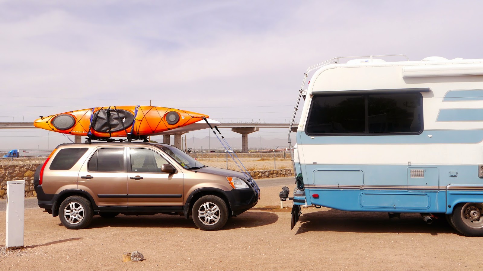
We made a quick stop at Balmorhea three years ago but never noticed another attraction just four miles away:  Balmorhea Lake.  So we put our kayaks in the water for the first time in four months.  Since the small digital camera I use on the boat now apparently belongs to Southwest Airlines, Jim took this photo of me with his iPhone.  

Saturday, March 29, 2014

The Mission Trail: Ysleta, Socorro and San Elizario, Texas

Our last day in El Paso we drove the Mission Trail, which is east of town. The 9-mile road is a small part of the El Camino Real de Tierra Adentro (Royal Road of the Interior) that ran from Mexico City to Santa Fe, and is the oldest and at one time the longest road in North America.  Spanish explorers used this road to explore this part of the New World.  

The towns of Ysleta, Socorro and San Elizario -- and two churches and one former military chapel -- make up the major historic stops.  I'm not up to the task of doing justice to this rich and complicated culture, but below are a few highlights of our visit.
At the Tigua Cultural Center in Ysleta we learned some of the five-century history of the Tiguas, who once lived on and successfully farmed the land that is now downtown El Paso. The Tiguas are the only Puebloan tribe still in Texas. Today they work to keep their culture alive and also own prosperous businesses, including Speaking Rock Casino and Big Bear Oil Company.
Th cultural center had shops like this one called "Eagle's Path."  The woman glazing a pot (her husband was stringing beads) told us that 80 percent of the items in their store were made by family members. 
The Ysleta Mission is the oldest continuously active parish in Texas, and the the town of Ysleta is the oldest town in the state.
Jim walks by a piƱata shop in Ysleta.  Next door was a tuxedo store. Ysleta was the busiest town we've seen on an Indian reservation. It had funky, small stores like above, plus bigger, shinier buildings. 
The inside of the Presidio Chapel in San Elizario.  Originally a chapel on a Spanish presidio (military base), the building was destroyed by a flood and the current chapel built in 1882. The pressed-tin ceiling tiles cover the original ceiling beams and were hand painted to honor soldiers returning from World War II. 
We've seen interesting metal artwork on homes and fences in New Mexico and El Paso. This piece is on a former San Elizaro dinner theater that was once the site of the 1850 County Courthouse Complex.
One of our favorite visits was the Golden Art Gallery in San Elizario, where we talked with talented artist Arturo Avalos, above.  Arturo gave us a great San Elizario history lesson. For example, the first Thanksgiving was held here 23 years before the one at Plymouth Rock.  Arturo told us about the Salt War, which broke out over control of nearby salt flats and ended in several town officials being killed.  Billy the Kid actually broke into a a San Elizario jail -- he went in disguised as a marshall with prisoners in order to free a friend.  Billy got the keys to the jail, locked up the sheriff, threw the keys on the roof, and headed to Mexico with his friend.  Arturo also described how huge the Rio Grande River used to be -- they didn't call it "Big River" for nothing -- but has been dammed and can be pretty non existent in parts, which has impacted local farming.  
We didn't visit the mission in Socorro but did have lunch in that town at a restaurant recommend by Arturo: El Meson de Onate.  Great idea. We love the food in this area. 
A downside of any geographic area with lots of open land:  We came back to our rig to find the wind had blown over our lawn chairs and twisted them up with our outdoor rug.  (An easy fix and well worth the trip on the Mission Trail, however.) Our neighbor told me her glasses blew away.

Friday, March 28, 2014

National Border Patrol Museum

This week we visited the National Border Patrol Museum and Library in El Paso.

The Border Patrol officially began in 1924. Today the mission of 21,000 Border Patrol Agents is to prevent people from illegally entering the United States, to prevent terrorists and terrorist weapons from doing the same, and to prevent illegal trafficking of people, guns, drugs, and other contraband. The Border Patrol is responsible for 4,000 miles of US/Canadian border, 2,000 miles of US/Mexican border, and waters off the Florida coast.

Border Patrol checkpoints are fairly common in the southwest.  We'll be driving along when suddenly we see speed reduction signs and lane closures that funnel us to a check point comprised of Border Patrol officers, vehicles, temporary buildings, dogs, and, I assume,   high-tech equipment. In our experience, the agent asks if everyone in the vehicle is a citizen of the United States, sometimes jokingly asks if our dog is also a citizen (Jim always says "he's not telling") and we're sent on our way. We've heard stories about motor homes being entered and searched, but that hasn't happened to us.  

If there are two agents, one talks to us while the other pretty intently looks into the vehicle.  If there is only one agent, he/she engages us in at least a brief conversation, probably to get an idea of our demeanor.  

The lines move quickly and we appreciate the presence of the Border Patrol.

But back to the museum:  Other than a movie that discusses current operations along the borders, none of the exhibits referred to anything after the mid-1990's. Some of the signs were just typed or photo copied.  But while many displays have a home made feel, it was interesting.  For example, we learned that in 1961 when there was a rash of air plane hijackings (and an attempted hijacking at El Paso International), Border Patrol officers were assigned to fly on airliners. We also read that Border Patrol agents were assigned to uphold federal law during the civil rights movement, and joined US Marshals in protecting James Meredith as he enrolled as the first African American to attend the University of Mississippi. 

And, Jim bought a Border Patrol T-shirt and hat at the gift shop.  He can wear it next time we go through a check point.
Metal statue at the front of the Border Patrol Museum.  The museum gets no federal funding and is free.
Part of the Border Patrol dog exhibit included this display of items used by the dogs and their trainers.  The brown pouches near the bottom are protective dog-paw booties.  The pipe-like tubes in the center are dog toys that agents stuff with drugs so the dogs can learn the scent.  
Some of the older vehicles formerly used by the Border Patrol.  The jeep to the right was  restored for the museum by mechanics students at an El Paso high school.  There was also a display about ways people and drugs are smuggled into the US, including a scrap metal and junk raft Cubans floated to the coast of Florida.  The raft was called "Voyage to Freedom" but the sign said all the occupants were arrested.
This RAD (Robot Against Drugs) visited elementary schools (along with a Border Agent, I assume) to discourage kids from taking drugs.  I'm not exactly sure how that worked.   
Not too far from the museum is this Border Patrol office.

Thursday, March 27, 2014

When you think "El Paso," what comes to mind?

Three years ago Jim and I drove by El Paso, Texas, on Interstate 10.  We saw dilapidated homes on the Mexican side of the border, traffic was intense, and all I could think was "I want to be someplace smaller and safer."  

This time we decided to stop in El Paso but were not expecting much.  We thought El Paso equaled crime, drugs and dust.

We stand corrected. 

Almost right off the bat, we heard that in 2014 El Paso was ranked the safest large city in the US for the fourth straight year by an annual study called City Crime Rankings and has been in the study's top three cities with the lowest crime rate since 1997.  Apparently we are not alone with our initial impression, however: two locals we met our first days here -- a young professional-looking man we met while exploring downtown and a server at a pub -- told us they loved El Paso but that it had an undeserved bad reputation.

And the downtown area is lovely.  Restored historic buildings.  A plaza that looks like something I'd imagine you see in a thriving Mexican town.  Pocket parks.  Walkable streets.

Never would have guessed.
Jim near El Paso's Convention Center.
The El Paso Zoo has a painting "Enrichment Program" for it's animals, and about a dozen of the pieces were hanging at the El Paso's Visitor's Center.  The painting above was done by a Sumatran Orangutang named Ibu.  Ibu is the only El Paso Zoo resident who uses a brush to paint and the zoo folks gave her a specially-designed brush that she can't break.  Ibu's favorite paint color is red and she likes to taste her paint.  And this didn't sound nearly as stupid when I read it at the Visitor's Center.
The Kress Building was designed by a company architect for the S. H. Kress and Company, which operated one of its "five and dime" store in El Paso from 1938 until 1997. Most of downtown El Paso seems bustling, but I think this building is empty.  I hope someone restores it because it has beautiful details.
Left: Centre Building, formerly the White House Department Store and Hotel McCoy.  It opened in 1912; the department store was in the basement and the hotel was housed the other six floors.  Right: Mills Building.  It once housed an architectural firm (Trost and Trost) that designed hundreds of buildings in El Paso and other southwest cities.  
A Tiffany stained glass dome in downtown El Paso's elegant Camino Real Hotel.
Artwork on an under-construction off ramp?  I'm not sure, but it's a fun look.
Our lunches at Leo's Restaurant in El Paso.  I had to try the chicken mole (above, front) because nearly 40 years ago I attempted this dish for a dinner party, couldn't find the needed ingredients, and faked it with chocolate and who knows what else (which is my usual cooking style.)  My "chocolate chicken" is still infamous among friends and synonymous for "yuck."  The one above was delectable. The guy we chatted with near the Convention Center suggested this restaurant.  Thank you, Mike!
An Aztec calendar sculpture in one of downtown El Paso's small parks. I read that another El Paso Aztec calendar has solar panels directing electricity to outlets people use to charge phones and other devices. Plus the park has free wifi.
A typical sidewalk display at the Downtown Shopping District near the Mexico/US border. We took a free shuttle to the market and were the only passengers not speaking Spanish.
Downtown as seen from near UTEP, the University  of Texas at El Paso.

And, just because we thought they were pretty, photos of a few houses near UTEP:


Wednesday, March 26, 2014

Mesilla Valley Wine Trail

Sunday we took a drive on a back road between El Paso and Las Cruces called Highway 28  or the Mesilla Wine Trail. The fertile valley along this road was formed by repeated flooding of the Rio Grande River. Local farmers grow grapes, chilies, onion, corn, cotton and pecans.

Locals have also been producing wine on this agricultural area since the Spanish first explored it.  Today there are at least four wineries on the approximately 30-mile-long road, but we stopped at just one: Sombra Antigua Winery, the trail's newest winery.

Owner Dave and helper Ehran told us about the winery and the Mesilla Valley while Jim and I each had two flights of terrific wine. We've been to a lot of wineries and I almost always sample a few a don't care for.  Not the case at Sombra Antigua.  After tasting and talking we bought a bottle of their red table wine and another red called "Theresa's Blend" (Theresa is Dave's "better half," as he called her, and runs the winery; she also makes and sells jewelry there and Bev bought a bracelet).

After all that wine, we needed some food.  Dave suggested we visit the nearby town of Mesilla, NM, and Mesilla has restaurants, so that's what we did.

Mesilla became a village in 1848 after a treaty moved the US/Mexican border and a group of citizens, unhappy at being part of the US, moved south.  The border was later (obviously) moved again.  Today Mesilla has about 2,200 residents, lots of adobe houses and shops, and a plaza ringed with street vendors -- at least on the Sunday we were there.  And Bev bought more bracelets.
Sombra Antigua Winery wine-connoisseur-in-training Ehran (this was his first weekend behind the tasting bar) and Dave, who owns the winery along with his wife, Theresa. Dave said he and Theresa  bought the winery in 2008 but have long been interested in wine.  Ehran is also musician who steps out from the bar to play acoustic guitar during live-music time. 
Bev (wearing three bracelets) at La Posta de Mesilla restaurant, recommended to us by one of the street vendors at the Mesilla Plaza.  It was a busy, pretty restaurant made up of so many small rooms that after a trip to the restroom I almost couldn't find my way back to our table. And no, that didn't have anything to do with all the wine at Sombra Antigua.
Pecan trees near Mesilla Valley.  We drove through one section of the valley where the trees were so big and so numerous it was like driving though a tree tunnel with trees as far as you could see.

Monday, March 24, 2014

In a corner of Texas

We like to stay at military base campgrounds.  Fort Bliss in El Paso is only about 90 miles from Columbus, NM, so a couple of days before we left Columbus, I called the Fort Bliss RV park to see how full it was since they don’t take reservations. They said they'd been having about five empty spots a day, which sounded like good odds.

The morning we left Columbus, I called Fort Bliss to see how many spots were open.  This time it was explained to me a little differently:  Apparently about five people a day had been leaving the base RV park, there was a waiting list to get one of the spots, and you can only get on the day's waiting list by showing up in person before 1 p.m. I did some quick research for a few Plan B campgrounds just in case, and we headed for Fort Bliss.

We drove to El Paso on NM 9, which skirts the Mexico/US border.  A park ranger at Pancho Villa State park told us it was a good road with plenty of Border Patrol presence, and that certainly was the case.  We only saw a couple dozen cars on all of NM-9, and most of those were Border Patrol. Once we got to El Paso, however, it was freeways and vehicles everywhere.  

We got to Fort Bliss around noon and got on the waiting list, but it was a no go. So we got back on the freeway and drove 20 more miles to a place called Mission RV Park.

Mission RV Park is not a vacation location.  While there was some greenery, our spot was in a gravel parking lot near I-10.  And it was $41 a night.  We don't usually pay that much, but the front desk staff was so nice, I’d stay again if need be.  

For example: The man who checked us said if we belong to Good Sam -- an RVer's club where you get campground discounts, roadside assistance and other stuff -- we'd get a 10 percent discount on that $41. We thought we’d just renewed our Good Sam membership but neither Jim nor I could find the card. So the man said he’d give us the discount and we could let him know the number later.  

After we got set up in our camping spot, we realized we didn't belong to Good Sam.  So Jim went to the office and was told we could still get the discount if we belong to AARP.  Jim told them we did, and said I'd call with the AARP number -- but we don't belong to AARP. 

So I went back to the front desk and told they man that we didn't have Good Sam or AARP but that we did apparently have Alzheimer's and I owned him $4.  He gave us the Alzheimer's discount.

Anyway, the next morning Fort Bliss called and said they had a spot for us.  So it was back on the freeway and back to Fort Bliss.  We're now at the Army's second largest installation (square-miles-wise) in the world.
Our camping spot at Mission RV Park in El Paso, TX.   The big ramp in the background is part of I-10 under construction, with actual I-10 below.
Our camping spot at Fort Bliss.  We're close to a freeway here, too, but the campground is clean, the spots are big, and it's only $17 a night.  

Our RV neighbors at Fort Bliss have two birds including Louie the Macaw, above, three dogs and I think a cat. On the other side is a man on active duty.  We don't usually see a lot of active duty people at the military RV campgrounds, but there are a lot of kid's bikes and toys here, and I bet half of the spaces are occupied by military families living in RVs.

Friday, March 21, 2014

Palomas, Mexico: The Pink Store and More

Yesterday we visited Palomas, the town from where Pancho Villa launched his attack against Columbus, NM, and the home of the "Pink Store" which sells folk art, jewelry, pottery and also has a restaurant.  A local told us it was OK to go to Palomas during the day, but not to go at night because someone "might knock you over the head."  OK then, day trip it is.

We drove the three miles from Columbus to the border, parked the car in a gravel lot, and walked across. Right after we entered Palomas, we were approached by three folks individually selling DVDs, sombreros and hammocks.  Last time we were in Mexico (Los Algodones near Yuma) we were asked so many times if we wanted our teeth cleaned that I thought I better buy some Crest strips.  But no one here asked us if we wanted dental work, eye glasses or medication, which are the big draws in Los Algodones.

Instead, the big draw in Palomas is the Pink Store, a literally pink building that's just as colorful inside as out. Most of what they sell is beautiful Mexican folk art, but they also had a display of stained glass NFL football logos. Jim felt his Seattle Seahawks were being unjustifiably ignored, as there was no Seattle Seahawk logo. My glass-half-full opinion was that they were sold out of Super Bowl champion stained glass.
Part of the border fence that stretches east and west on both sides of the border crossing into Palomas, Mexico, a city of about 4,700 people.
The Pink Store (La Tienda Rosa), plus a couple of guys just hanging out. The same owners have operated the Pink Store for 25 years. 
Hand made, hand painted, clay chickens as seen at the Pink Store.  We were told that the store owners travel across Mexico to select folk art they sell.
You see a lot of skeletons -- dressed in hats and other clothing --  in Mexican folk art, like the figure on  the right. The creature on the left, however -- I don't know what the heck that is.
While there was no Seattle Seahawks stained glass, the Pink Store did feature the San Francisco 49ers.  This one is for you, Pat and Cindy.

Waiting for lunch and drinking Negra Modelos at the Pink Store.  I'm not a big fan of the beer but Jim must have thought it was OK because when I wasn't looking he swapped my nearly full bottle for his empty one.

Jim ordering at the Pink Store restaurant. He had the "Pancho Villa Plate -- cheese enchiladas, chile rellanos, ground beef taco, rice and beans.  Bev had the Generalissimo Zapato Tacos -- grilled beef and onions on corn tortillas, avocados and beans.  Both were excellent and our waiter was a sweetheart.
A Mexican troubadour serenades a Mennonite family during lunch at the Pink Store. Per Wikipedia, about 100,000 Mennonites live in Mexico, with most of them in the state of Chihuahua, the home state of Palomas. We also read that Mennonites make the cheese served by the Pink Store Restaurant.

Bev with statues of Pancho Villa and General John J. Pershing on the Pink Store plaza.  The US government had at one time backed Pancho Villa and we saw photos of US General John J. Pershing  meeting with Villa.  After Villa's attack on US soil, Pershing led what was called the "Punitive Expedition" to track Villa down.  Pershing was not successful.  

A dove/paloma takes a break on a statue of Pancho Villa near the border crossing in Palomas.

And, like with most border towns, the ubiquitous dental clinic.