Thursday, November 8, 2012

Yuma, AZ and the Yuma Proving Ground

We’ve been in Yuma, AZ since Tuesday and are staying at the Desert Breeze Travel Camp at the US Army Yuma Proving Ground, about 10 miles north of the city.  Yuma is in the southwest corner of Arizona and shares a border with both Mexico and California. 

I was really surprised to find that agriculture is the number one industry in Yuma.  In addition to having a John Deere tractor pulling a disc get on the freeway in front of us, we saw a lot of crops. In fact, 90 percent of all leafy vegetables grown in the US from November to March come from Yuma county. I don’t have any crop photos yet, but have to get some because they are very pretty.


As for the Yuma Proving Ground, it established in 1943 to test mobile bridges used in World War II and as a training site for the infantry and mechanized troops (troops that use tanks and other vehicles that protect them from hostile fire).  Today the YPG tests weapons systems, vehicles and other equipment headed for the battleground. About 500 troops are stationed here year round, but another 2,300 contractors make it one of the county's largest employers.  Also, George H.W. Bush made the second parachute jump of his life at the YPG in 1997 at age 72. His first was in 1944 when his plane was shot down during World War II.

Jim and an "overland train control car" not far from our 
RV park at the Yuma Proving Ground.  It was developed  
to transport heavy cargo through undeveloped areas, was 
the front car of a total of 13 vehicles, and has living 
quarters for six people in it.
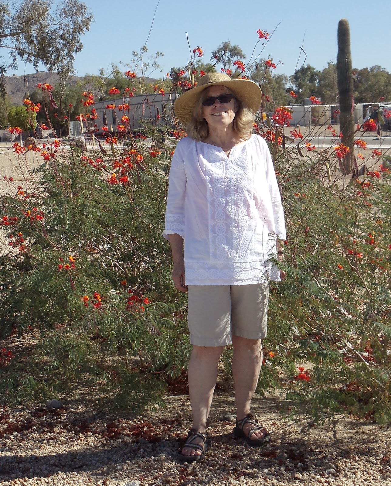
Bev and some desert flowers at the Yuma Proving Ground.  It's so hot here I'm actually wearing shorts which I rarely do.  The first two days it was in the 90's; the local weatherman says that's about 10 degrees above average for November.  Today it's cloudy and cooler -- it even rained toward evening -- but I'm still wearing shorts. 
We took a trip to nearby BLM land where a lot of people camp in RVs very inexpensively.  It was hot and dusty, and while it has an "away from it all" charm, I couldn't see doing something similar for very long.
Also near the Yuma Proving Ground is a resort called Hidden Shores VillageIt's on the Colorado River and has the above very well-watered golf course. You can actually rent RV spaces there, plus it has small homes.
Our RV spot at the Yuma Proving Ground is about ten 
space down from the above tank.  Seriously.

Jim and Cooper on the YPG base.  I've posted two photos here with very green grass -- but it has to be extremely well watered to stay that way, and the field you see here is practically flooded.

Election Day


We got to Yuma, AZ on election day and stayed up late watching the results on TV.  Late for me, anyway, since I usually crawl into our sleeping loft at sundown to read.

Jim and I voted by mail before we left Salt Lake City in late October.  Since we’d spent most of the last 14 months out of state, I knew I wasn’t up to date on local issues.  But I was still really surprised to discover that my congressional district had changed, and the name of the man who’d been my congressman for six terms wasn’t on my ballot. Instead, my choices included a congressman who'd leg wrestled Stephen Colbert on TV.

When I researched my school board candidates, I discovered one of them was a convicted sex offender.  I’m thinking, well, maybe it was a bad decision a long time ago between two teenagers. Instead, it happened when he was in his late forties and involved an eight-year-old girl.  I’m all for second chances, reinventing yourself, paying for your mistakes (he spent five years in prison) etc. But I could’t get past the crime.  Not to mention the fact that as a convicted sex offender, he would not be able to enter the schools he’d oversee without special permission. 

The sex offender didn't win. My former congressman did, barely, and my leg-wrestling rep won big time.

Monday, November 5, 2012

Quartzsite, Arizona

Quartzsite, Arizona  -- with a year-round population of just under 4,000 people -- looks like a huge RV parking lot.  RV parks are everywhere.  In the winter they are filled with “snowbirds,” most of whom come to Quartzsite in their fifth wheels RVs and motor homes.  In fact, an estimated two million people come to Quartzsite for the winter and/or to attend huge gem and mineral shows, swap meets, and RV shows.  Per the Quartzsite visitors' guide, the town has 70 RV and mobile park homes, plus camping on 11,000 acres of Bureau of Land Management property.  You can camp for free on most of the BLM for up to two weeks with a permit; for BLM land closer to town it costs $40 for 14-day permits which you can extend for up to seven months.  We’re staying where it’s free and are only a couple of miles out of town.

Today we briefly explored the town and then came back to the rig, enjoyed the scenery here at our campsite, and I read the tourist literature we picked up.  I should have read it in the car, because next time I want to see these three things:

The Great Tree:  Near the Quartzsite Town Hall is an ironwood tree that’s supposedly over a thousand years old.

World’s largest saguaro cactus:  I do love the saguaros.  And near Castle Dome Peak south of Quartzsite is what’s claimed to be the world’s biggest, with 47 “arms.”

The Hi Jolly Monument: The US Army once brought camels and their drivers from the Middle East in an attempt to introduce camels to the American Southwest.  The experiment failed and the drivers left except for one man named Hadji Ali.  Locally known as Hi Jolly, he became a prospector.  A memorial at the local cemetery pays tribute to him.

A pretty typical view near downtown Quartzsite, Arizona. 


Sunday, November 4, 2012

Three states in one day

First, I obviously changed the top photo on our blog to one I took this afternoon at our Quartzsite, AZ, campsite.

As for what we are up to: Yesterday we were still at Nellis Air Force Base in Las Vegas and it was chore day:  laundry, clean the rig, figure out where to get gasoline on our way out of town (found it for $3.55 a gallon, the least expensive we’ve seen lately.)  Plus Jim watched football while I read a great memoir by Richard Russo called “Elsewhere.” 

This morning we headed towards Quartzsite, AZ.  Las Vegas is in the desert, but once we turned south onto US 95 near Boulder City, NV, the 200 miles we drove to Quartzsite really looked like the desert. No Stratsosphere skyscrapers here, let alone buildings over one story.  Let alone buildings, period.  It was brown and gray rocks, scattered Joshua trees, a few ocotillos, and mountains in the distance. Scrubby desert; beautiful in its own way but not somewhere you’d want your car to break down.  The closest city to the west was Barstow, CA, about 150 miles away.  To the east was Lake Havasu City, AZ, which you can’t get to from most of the desert we were in because few roads crossed the lake.

And now we are in Quartzsite, which we’ll explore tomorrow.  Quartzite is kind of famous in the RV world because it hosts a huge winter RV show.  It also has about 6 large Bureau of Land Management areas were people can stay for free for 14 days.

High desert chaparral as seen from the passenger window somewhere in California.  Or maybe it's low chaparral.
We were in three states today:  Nevada, California and Arizona.  Here's another view out the rear window of the rig as we move down US 95 in California.
And yet another view.
If you are on RT 95 and find our hubcap, let us know.

Bev at our campsite in Quartzsite.  Jim said Quartzsite's motto is "Rock capital of the world."

Friday, November 2, 2012

Joni, Kim and the Railroad Tunnel Trail

Yesterday Jim and I had lunch with former Salt Lakers Joni and Kim.  Joni was a paralegal at the USPS Law Department when I started that same job in 2002. In 2004, Joni transferred to the USPS Las Vegas HR Department and she and Kim moved to Vegas. The Law Dept missed her and so did I. So when I got to Vegas, I had to get in touch with her; she suggested we all meet for lunch at Lucille’s Smokehouse Barbecue in nearby HendersonIt was a great lunch.  And, it was good to see both Joni and Kim and to catch up.

Joni and Kim like to hike.  So when they told us about the Railroad Tunnel Trail near Hoover Dam, Jim and I knew what we were going to do today.  The trail is the site of former tracks for trains that hauled rock, huge pipes, and other materials needed to build Hoover Dam in the 1930s. In the1960s the tracks were removed; today that same site is a flat and scenic trail along the hills south of Lake Mead.
Bev and Joni with our hair caught in the wind.
Jim, Bev, Kim and Joni.
Jim on a side trail taking us from a parking lot at the Hacienda Casino in Boulder, Nevada, to the to the Railroad Tunnel Trail.
Bev in front of two tunnels tunnels blasted out by those who helped build the Hoover Dam.  The tunnels are 18 feet high and 27 feet wide.  As an aside, my legs are sure white.
Jim and Cooper on the Railroad Tunnel Trail with Lake Mead in the background. In the 1930s, instead of a lake you would have seen "Ragtown," a makeshift village of cardboard homes, wooden cabins and tents that housed hundreds of people who came with their families to build Hoover Dam.
Jim exiting one of the tunnels. He overheard someone from an overlook call Cooper a big-horned sheep.  Must have been a city boy or someone with bad eyes.
Jim and Cooper in front of another tunnel. Although it was 
warm today (high 70s) about two-thirds of the hike was  
shaded by a a tunnel or a mountain. 
Before hiking the Railroad Tunnel Trail, we took a look 
at Hoover Dam.  It's the curved concrete structure 
toward the left of the photo.  You can drive or walk 
across the top.
The Hoover Dam folks requires people with pets 
to park in a specific (and shaded) parking lot.  
Here's Jim with a hard-to-see Cooper.
The view of Lake Mead as seen from the top of the 
dam.   The white rock just above the water is the 
"bath tub"ring that shows how high the water has 
been in the past.  Per the Hoover Dam brochure, 
this water project provides irrigation for a 
million acres in the US and a half million acres 
in Mexico.
These electrical towers are just below the dam and 
are bolted onto the side of a cliff.