Thursday, April 25, 2013

A capitol return

The morning we left Bryce Canyon, I turned on the bathroom faucet.  Nothing.  Uh-oh.  We’d left the water hose connected to the rig all night; apparently it got below 32 degrees long enough to freeze the hose solid and burst our water filter. 

Nearly two years on the road and we still made a rookie mistake. Other than the disposable filter, however, nothing else was damaged.  So as soon as the hose thawed enough to coil it, we put it in the shower to drain, threw the filter in the trash, and drove to our next stop:  Capitol Reef National Park.

We’ve been to Capitol Reef many times before (actually 8 times during the nine years Jim and I have been together) so it’s obviously a favorite.  No matter where you are in the park, you have amazing views of red cliffs, orange and red canyons, white domes and castle-like rocks I can’t adequately describe.   Capitol Reef is also close to the little town of Torrey, Utah, that has several funky and good restaurants. 

Since Capitol Reef is a little off the beaten track, it’s  less crowded than Arches, Bryce or Zion.  So when we arrived on a Sunday -- a day campgrounds usually empty out as weekend visitors leave for home -- we expected the campground to be nearly empty. Instead, at 2 p.m. it was nearly full.   We grabbed one of the few remaining spots and by 5 p.m. all the sites were taken.  

Bottom line, however:  we had a great time at Capitol Reef but had to leave for an important engagement home in Salt Lake City: grandson Marshall's first birthday, which was yesterday.  I'll post a few times while we're home, but check back for sure in about a month when we take off for another stint on the road.
Our broken water filter with the hose thawing in the shower behind it.  It was time for a new water filter anyway.  
Capitol Reef's campground is nestled among cottonwood trees and fruit orchards. Bonus: the park sells pie made from local fruit, so I had cherry pie for breakfast. Jim saved his for lunch.
A larger view of the campground. A ranger told us spring and fall are actually Capitol Reef's busiest times because the weather is milder.  Before this trip we'd always gone in July, and it is pretty darn hot -- but still wonderful.

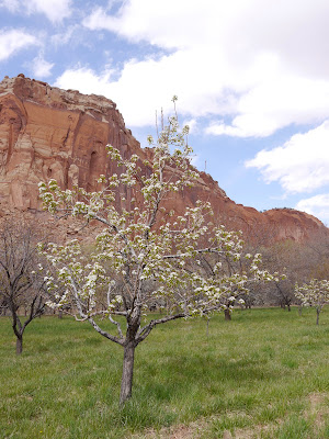
An apple tree in early blossom.  In the fall you can pick and eat apples for free.

And another view of the campground, this time from one of 
our favorite Capitol Reef hikes, Cohab Canyon.
Bev on the Cohab Canyon trail. While hiking we stopped and talked with a couple from Oregon and six people from Canada.   
Jim on the trail. Besides the hiking, we also love Capitol 
Reef  because the nearby towns of Torrey and Bicknell 
host the The Bicknell International Film Festival (the 
BIFF). With the theme is "Better Living Through Bad 
Cinema," it offers exactly that: Bad movies plus a lot 
of fun. Among the hits we've seen: The Attack of the 
Killer Tomatoes (complete with a talk from the guy who 
made it); and Terror in Tiny Town an uncomfortably 
interesting movie.  
Grandson Marshall enjoyed his first birthday cake 
yesterday.
Our house in SLC. It's a mid-century modern -- a newer name for an old house that always needs a lot of work.
I often post views of what we can see from our rig.  Here's a view of what we can see from our home's kitchen window.  
And here's the rig at the end our street, waiting for a trip to the storage lot and later trips for routine maintenance. 

Saturday, April 20, 2013

Short shrifting Bryce

Maybe it's because we've recently been to umpteen state and national parks.  Maybe it's because we're on the homestretch.  Or maybe it's because, I'm embarrassed to say, at this point every park story sounds like the following:  Shallow sea, dinosaurs, the color of the rocks is caused by [insert local mineral here], uplift, erosion, primitive peoples, Native Americans, conquistadors [or Spanish priests, fur traders, Mormons or John Wesley Powell], permanent settlers, and there-is-no-where-else-on-earth-like [insert park name here]. I've missed a few but you get the idea.

So.  Today we took a short tour of Bryce Canyon National park. It really is a beautiful place and has what appeared to be some great hiking.  But our Bryce tour consisted of the visitors' center, three scenery overlooks and driving half of the 18-mile park road.
To get to Bryce, we drove through nearby Red Canyon, 
which is called a mini Bryce and has views like the 
one above.   These photos were all taken with Jim's iPhone, 
because while I had my camera, I left the battery in the rig. 
Another sign of sightseeing overload, perhaps?  
Bryce Canyon's Natural Bridge, which the park says is
technically an arch. Either way it's beautiful.
Jim and the view.  Bryce Canyon is named after early
settler Ebenezer Bryce who described his canyon as
"a hell of a place to lose a cow."
Bryce Canyon is not really a canyon.  Instead
it's a ponderosa pine forest on a bluff with views
of cliffs.

Friday, April 19, 2013

Beauty and the asphalt

Yesterday we did three short hikes near Page, Arizona.  The first one was at Horseshoe Bend, just south of Page, and was actually recommended to us by a gas station attendant at the Grand Canyon.  Then we walked to Glen Canyon's beach area and a place called "Hanging Gardens," both just north of the Glen Canyon Dam.  

This morning we left Glen Canyon and drove 70 miles to Kanab, Utah.  Kanab is a pretty  town, but it's in a mess right now because its main street is being resurfaced and there are lane restrictions and closed roads everywhere. We couldn't even get through the orange cones to the private RV park we wanted to stay at until we found a grocery store parking lot, unhooked our tow car, drove back and figured it out.  

After getting the rig settled in, we drove to the Coral Sand Dunes State Park and then to the Best Friends Animal Sanctuary. On the way, we saw the resurfacing crew at work on the north end of town.  We figured they wouldn't get anywhere near the south end of Kanab and our motor home park today.  So it shouldn't be hard to guess where the asphalt crew was when we came back:  right in front of the motor home park.  I mean exactly in front of it.  A woman on the crew told us to park across the street in a dirt field, walk over the asphalt and then get our car after a couple of hours. We ended up not walking on the asphalt because it was too hot, but we did get both us, Cooper, and eventually the car back to the rig. Now we just have to get out of here tomorrow.
Wednesday's evening view of Lake Powell from our
motor home. 
Me and my shadow taking a photo on our hike to Horseshoe
Bend, where there is a 270 degree bend in the Colorado
River.
Jim peaking over the cliff at Horseshoe Bend.
Jim and Cooper looking into the Colorado River at 
Horseshoe Bend.

This is the beach at Lake Powell.  The white area on the
 rock  is the "bath tub" ring left by receding water.  And
the little white speck near the left of the photo in the water
is a speed boat.
Bev and Cooper at the Hanging Gardens, the destination
of our last hike of the day.  We walked through sand and
slick rock to a depression in the north side of a cliff -- and
found ferns and a 20-degree drop in the temperature.
Part of an interesting street in Page, AZ: 8th Avenue or
"Street of Little Motels" that's filled with small motels
like this one.  Part of another street is known to the
locals as "Church Street" because there are 12 churches
pretty much all in a row.
The scenery from Page AZ to Kanab, Utah, was beautiful,
with cliffs in shades of red, russet and cream.
We took a short hike on a nature trail at the Coral Dunes
State Park, northwest of Kanab.
We met these volunteers at Best Friends Animal
Sanctuary near Kanab.  Best Friends is a no-kill
animal shelter with the goal of "no more homeless
pets."  The horse on the left is 30 years old and we
were told he's been at the shelter 27 years.  On
the right is a 13-year-old Shetland pony.  The
pony has thick, wiry hair, which the volunteer
told us is caused by Cushing's Disease.
The blocked-off entrance to our RV park in Kanab,
complete with  very fresh asphalt in front of it
.

Wednesday, April 17, 2013

On the Utah-Arizona border: Glen Canyon National Recreation Area

We planned to leave the Grand Canyon yesterday, but 68 mph winds got in the way. It didn’t feel that windy, probably because we were in a campground with trees, buildings and big rigs to protect us.  But a 33-mile stretch of Interstate 40 was shut down all day because of wind and dust, so it was bad.
This morning was cold but calm, so we took off for Glen Canyon National Recreation Area at the Arizona/Uah border.  AZ 89 just south of Page, AZ, is closed due to a “geologic event” that happened in February, so a detour added 50 miles to the trip.  But the drive was beautiful.  Our route included last glimpses of the Grand Canyon (which after four days still looks like a theatrical backdrop), juniper forests, sand dunes, hoodoos, red rocks and now Lake Powell.
A photo of the "geologic event" that closed US 89 just south of Page, AZ.  According to news reports, it will take at least two years to fix.  In the meantime, a dirt road on the Navajo Reservation will be paved as an alternative route -- but that hasn't happened yet.  Thanks to the Arizona DOT for this photo.
Some of the gorgeous scenery we saw on our way to Glen Canyon National Recreation Area just  north of Page, AZ.  We ran into a little bit of snow on the drive -- the first time we've had snow on our travels.
Our campsite at Wahweap Campground at Glen Canyon.  At
$48 a night it's one of the most expensive campgrounds
we've been to -- I think only our site in  downtown New
Orleans cost more.  Plus they charge two bucks for a
shower.

The view from our campsite.  Maybe it is worth $48 
a night.
The Utah-Arizona border is only a few hundred feet from 
our campsite.  This is the first I've been back to my 
adopted home state since the end of December.
Lake Powell was created by the Glen Canyon Dam, finished 
in 1966. The Sierra Club and other organizations have 
called for the dam to be removed and the lake drained.

Monday, April 15, 2013

Scenery overload

My brain is on scenery overload. Yesterday we drove the 25-mile Desert View Drive, the road that follows the Grand Canyon's south rim from the main Visitors' Center to the park's east entrance.  The road has 15 pull offs where you can park and look.  We stopped at about half of them plus went to the east entrance visitors' center.   

On the way back we took a short detour to Tusayan, AZ, seven miles south of the park, and saw the Grand Canyon IMAX movie.  It was cheesy (it ended with crashing cymbals, an American eagle and a lightening strike) but had gorgeous views and all those makes-you-sick-to-your-stomach shots from low-flying planes and ricocheting river rafts.  

This morning we walked part of the paved trail that hugs the edge of the south canyon rim. Afterwards we were going to have lunch at the Canyon Cafe near the main visitors' center.  Instead we watched TV coverage of the Boston Marathon bombing.  Then I called my kids just to touch base.
Jim at one of our Desert View Drive stops.
Depression-era architect Mary Colter designed the "Watchtower" near the park's east entrance.  She also designed the Painted Desert Inn that so impressed us at the Petrified Forest near Holbrook, AZ.   The first floor of the Watchtower is a gift shop; you reach the other three floors and their views via a spiral stair case. As an aside, in 2008 two self-proclaimed "grammar vigilantes" used permanent marker and a white-out-type product to change a comma and an apostrophe in a sign Colter hand painted.  The grammar cops were banned from public parks for one year and ordered to pay restitution.

Near the Watchtower with our first Grand Canyon view of 
the Colorado River.
This morning we walked on the canyon rim trail. It was 
colder and windier than yesterday; hence the winter coat. 
 
Jim and Cooper leave the paved trail that runs along the 
canyon's rim to look over the edge.

Another shot taken this morning while walking on the trail that runs along the edge of the south canyon rim
 And yet another view seen this morning.


Our only gripe about the Grand Canyon is our campground, 
Trailer Village.  Camp sites are comprised of  disintegrating 
asphalt, the picnic tables are beat up, and it's just generally 
shabby.  We're hoping the big rigs here help buffer us from 
the high winds expected tomorrow:  65 mph, which is worse 
than it was a few days ago in Gallup, NM, when the wind blew 
sand through our window frames.  

Saturday, April 13, 2013

The Grand Canyon's Bright Angel Trail

Bright Angel Trail is the most-used trail at the Grand Canyon.  It’s a 9.3 mile hike from the canyon rim to the campground at the Colorado River. It’s also the trail where mules carry tourists down the trail.  

Jim would like to do the entire hike sometime, but today we just did three miles total down and back.  It took us one hour to do the 1.5 mile trip down the trial (including time for Bev to stop and take photos) and an hour to do the 1.5 mile trip back up (with time for Bev to stop and breathe.)  From the rim to where we turned around, there was 1200 foot difference in elevation.  
Jim near the beginning of Bright Angle Trail. There were a lot of other  tourists on the trail; we guesstimate about half of them spoke German or Dutch.


Bev near the beginning of Bright Angel Trail.
Jim a little later after we'd shed our sweatshirts. We saw an 
adult and two kids running pell-mell down the trail, which 
seemed a tad dangerous.
Bev where we stopped for a cheese, granola bars and a banana on the way back down.
Jim takes a detour from the well-maintained trail.

After the Bright Angel hike, we walked another two miles along the rim of the canyon. My knees still hurt.

Friday, April 12, 2013

Even Jim is impressed

When we first walked up to Mather Point, which is the viewing area near the Grand Canyon Visitors' Center, a little girl near us yelled "It looks like a painting!"  She repeated that two more times.  Then Jim walked up and if you haven't read the title of this post, please do.

Photos do not do the Grand Canyon justice, but here they are anyway.