Saturday, September 27, 2014

Damn spam scams

We’ve been getting an RV load of spam comments on our blog lately.  Spam has shown up the entire seven years this blog has existed, but lately it’s ridiculous.  
What is even odder to me (and if anyone out there knows the reason for this, let us know) but most bogus comments list a single post as the one they supposedly read and commented on: a post about a trip to San Antonio, Texas.
The blogging service we use is pretty good about directing these comments to a spam file, so usually no one sees them except us.  And reading them can be entertaining.The majority appear to be from non English speakers who put their message into an inferior Internet translation page, then type in the results with even worse keyboard skills. 
A few verbatim snippets: 
--Every weekend i used to pay a visit this web page, for the reason that i want enjoyment, for the reason that this this website conations actually fastidious funny information too. 
--Generally I do not read article on blogs, however I wish to say that this write-up very pressured me to check out and do so! Your writing taste has been surprised me.  
--I just stumbled upon your web site and in accession capital to assert that I get actually enjoyed account your blog posts.
Others are nonsensical considering that we've often posted photos of food.
--We are a society that does not seek to take ownership and responsibility. Somehow it was nice to have a choice whether to eat or not to eat.  
There are plenty more, but you get the idea.
As I understand it, software exists that will (for a cost) send out millions of spam comments with a “personalized” message like those above. You purchase the software, use a template to write your message, the software supposedly fills in the blanks, and voila: a legit-sounding comment. Obviously easier said than done.
The comments include a web address, but the rule of thumb for the blogger is to never click on it.  If you do, in a best case scenario it will take you to a harmless ad. In a worse case scenario your computer gets a virus. We never click. But if even a few folks do, the spammer gets a financial reward.
I find it all so unlikely to be successful, kind of like the scam telephone calls my Mom’s gotten lately. In one, a kid called her “Grandma” and asked her to send him money because he was in trouble. In the other a man told her my Dad -- who died in 1970 -- needed to call the IRS about tax fraud. 
The only clicking on those happened when Mom hung up the phone.

Thursday, September 25, 2014

Up the lazy river

We kayaked the Tualatin River last year during a Portland area visit. We paddled north and heard urban noises like lawnmowers we at first mistook for boat engines.  

This time we paddled south and and you'd have thought we were ... well, somewhere other than just south of major metro Portland. After we passed the construction going on near (let's face it, immediately adjacent to) our RV park, we could have been in the wilderness.

The Tualatin River runs right behind our RV park but begins in the Tillamook State Forest.  That's west of here in the Oregon Coast Range and where Jim was based for the entire 20 years he worked for the Oregon State Department of Forestry. The Tualatin ends when it meets the Willamette, the river that spits Portland into its east and west sides.
You'd think the 27 creeks that feed into the Tualatin would give it a little oomph -- but the river is slow.  In fact, we read that "Tualatin" is probably a Native American word for "sluggish."  For us, "sluggish" translates to "good for kayaking."
We put our boats in the water at a small launch site within walking distance to our RV Park and below where US 99 West crosses the Tualatin River.  A couple days ago there was an accident on the bridge to the right, which is north bound only.  A guy in an SUV headed the wrong way on the one-way bridge.  He must have scared himself and the opposing traffic, but it didn't look like anyone was injured.
The reflections in the water were so intense that you could almost lose your sense of what was up and what was down. 
A heron camouflaged in a tree's moss and branches.
Another reflection photo.  At times the trees in the water almost looked like deliberately planted pots of flowers and grasses.

Jim suggested we take our boats out at a small hillside behind our RV.  I looked at the steepness and the small depressions in the dirt that served as feet/hand holds and said no way.  Jim saw a challenge.  

Ta da!

Sunday, September 21, 2014

With the Portland branch of the family

We're in the Portland area, where daughter Season, son-in-law Lee, and grandsons Owen (age 5) and Connor (2 years 8 months) live.  So far we've played T-Rex; solved puzzles; watched football (with great results for this group of Oregon State and Seahawks fans); eaten (a lot); done laundry; taken walks (the Tualatin River National Wildlife Refuge was especially nice); and generally hung out.  

Below are a few pics, all but one taken with a somewhat goofy setting on my camera meant to make photos look like illustrations. I'm thinking they look more like cartoons -- but that may be the poses. 

Owen and Grandma Bev.
Connor was not quite as enthusiastic about posing as was his brother. But he did let me click off a couple.
Season and Owen.
Owen and his cowlicks.
The boys together.
What they really look like -- this time with their dad plus Owen in the super hero pose.

Friday, September 19, 2014

Surfin' USA

From Forks, Washington, we took off for campgrounds closer to the beach.  The first place we stayed was Copalis Beach, Washington, a tattered little beach town near a wonderful ocean shore. Lots of Washington's shore is rocky and narrow, but the beach here is deep and sandy.

Copalis Beach is in the middle of Washington state's Pacific shoreline and about 75 miles west of Olympia. It's one of seven little beach towns (Ocean Shores, Ocean City, Copalis Beach, Seabrook, Pacific Beach, Moclips and Toholah) north of the big inlet of Grays Harbor. We visited all of them.   

After Copalis Beach we went to Seaside, a tourist town that in 1806 was salt gathering spot for Lewis and Clark. Seaside has lots of hotels and restaurants, plus candy, gift and clothing shops. It also has a new brewery called Seaside Brewing (of course we visited) and we walked along the beach.  

The next day we went to Cannon Beach. Very pretty, very well manicured despite the wind off the ocean  -- just a lovely town.  It's one of he first places Jim and I visited together; back then we stayed at a wonderful small hotel called the Stephanie Inn. 
A rose among thorns, or maybe vice versa, at Copalis Beach.
Our last night at Copalis Beach, a big bank of clouds appeared.  By the time I got from the beach to the rig, I was surrounded in mist.
Driftwood sculpture near the planned coast city of Ocean Shores, Washington. 
As we drove toward Seaside, we saw signs for Lewis and Clark National Historical Park.  Since we'd been in the area before and visit almost every L/C site we pass we thought "How did we miss this one?"  So the next day we went exploring. As we approached, things seem familiar.  In fact, we had been there before, but arrived just as the gates closed. This time we saw two movies at the Visitors Center, hiked, and visited a reconstruction of Fort Clatsop, above, where the Corps of Discovery spent four months during the winter of 1805 -1806.  It was their last encampment before returning home.  The original encampment decayed; what's there now was built using detailed plans recorded by William Clark.
Cannon Beach, Oregon, tourists in front a a palm reader's shop.  She was doing a great business; must have been a good news day.
Photo albums of Cannon Beach always include a pic of Haystack Rock, which can be reached on foot when the tide is out.

Thursday, September 18, 2014

A dry day in the rain forest

From Forks, WA, we took a wonderful day trip to Hoh Rain Forest on the west side of Olympic National Park. Wow. In addition to a couple dozen different shades of green, we saw moss, huge trees, ferns, and plants growing on top of other plants (called epiphytes).  It's beautiful.

We also lucked out on the weather. The Hoh Rain Forest gets gets between 12 and 14 feet of rain a year. I can't even imagine that; where we have a home in Utah gets about 17 inches a year.  Where I grew in Ohio gets maybe 40 inches (and that seemed wet).  Even Portland only gets about 42 inches a year. 

But the day we visited Hoh it was unusually sunny and dry.  
This Sitka spruce is one of many huge trees at Hoh Rain Forest in Olympic National Park.  Other trees common to Hoh are big-leaf maples, western hemlock, Douglas fir, western red-cedar.
Moss hanging from a tree.  You'd think such moss would smother a tree, but according to signs in the park the moss does not harm the tree and only feeds on light and air.  
Mossy branches as seen by my camera's water color setting. When we were at Hurricane Ridge I met a fellow visitor who described Hoh as a "beautiful and dripping" and with all that moss I'm sure it usually is.
When one tree goes down, many others sprout on top.  Aa the fallen tree decays, its organic matter nourishes the new trees.
Jim by a tree that once had a "nurse" tree under to support it as a seedling.
We hiked about two miles through the Hoh Rain Forest.  We saw backpackers heading off on the 17-mile trek up Mt. Olympus, but for that you need what the park calls "Glacial travel skills and equipment." 

Monday, September 15, 2014

Forest, ocean, and vampires: Forks, Washington

We chose the small, western Washington town of Forks as our next campsite location because the mileage was right and there were interesting places nearby.  That's our basic criteria for most any place we stop.

We had no idea that Forks is the setting for the Twilight series of young adult fiction (and now movies) that's gotten lots of media attention. Probably because we haven't read the books or seen the movies. We just know they have to do with vampires, werewolves, and star-crossed love. Just like us :)

We also had no idea that the date we chose to visit Forks was a party for the story's protagonist called "Bella's Birthday Weekend" -- complete with a dinner and big bonfire. We did see signs for tours and, appropriately enough, a blood drive. Apparently author Stephenie Meyer was in town, too.

While others were celebrating Bella's birthday, however, we went to the ocean, visited Hoh Rain Forest in Olympic National park, explored Forks, and kayaked.  More on the Hoh Rain forest later.
This tree washed up on the beach near La Push, Washington, 16 miles west of Forks. That's Jim at the top.
The day we visited the beach at La Push and also nearby Rialto Beach (the latter is part of Olympic National Park) a lot of folks were surfing.
We saw this guy as we were leaving Rialto Beach.

Jim's favorite display at the Forks, WA, Timber Museum: Chain saws.  We've seen a lot of full logging trucks this trip.  The logging industry hit hard times in the 1980s, but a volunteer at the timber museum told us logging is big once again as the trees have had time to grow.  The volunteer said most of the logs are exported to China.
The campground we stayed at in Forks (Forks 101 RV Park) was fine but this rig at the edge of a road the campground shares with private property was a tad off putting, as was a nearby sign on a wood pile that read "Danger.  Due to ammo shortage there will be no warning shot."  Despite all that, I'd recommend the park if you don't need fancy and can get the Passport America rate of $17 a night. But don't take any wood.
The Twilight tour included stops at Bella's house,  Dr. Cullen's parking space, the Cullen home, and Forks Outfitters where Bella worked --  and I have no idea what any of that means.  A Chamber of Commerce rep told us author Stephenie Meyer wanted a rainy setting for her books (vampires need cloudy weather), researched locations on line, selected the Olympic Peninsula, and then looked at a map and liked the name "Forks."
The tide was just starting to come in as we began kayaking on the nearby Dickey River, so parts of the river were still low.  Here Jim drags his kayak across a sand bar.  Then  Jim dragged my kayak -- with me in it-- through the shallow water.  If we'd started kayaking when the tide was going out we might have gotten stuck in the mud.
Jim ponders how to maneuver between branches.  
At the confluence of the Dickey and the Quillayute River -- and just before together they dump into the Pacific Ocean -- the water was more open.  The name "Dickey" is a corruption of a Native American word for "people who live on the dark water."  

Sunday, September 14, 2014

Hurricane Ridge, Olympic National Park

A couple of days ago we drove from Port Angeles, WA, to Hurricane Ridge, a mountain area at the north end of Olympic National Park. The winding, 17-mile drive ends at an almost eye-level view of mountain peaks.

We went to the Visitors Center, hiked, saw lots of deer (we've seen so many lately I've quit taking photos of them), lots of marmots (big ground squirrels) and amazing views.
As we approached the Hurricane Ridge Visitors Center, a huge cloud was going by.  It was like looking at a cloud out the window of an airplane.
Hurricane Ridge is named, obviously enough, for gale force winds the area gets -- but the day we visited it was calm and beautiful.  
Another cloud photo. The Hurricane Ridge area of Olympic National Park offers skiing and snowboarding in the winter and gets an average annual snowfall of 400 inches, says the park website. 
You can see the road we drove in the middle of this photo. The road starts  near sea level in Port Angeles and ends at the Visitors Center at 5,242 feet. 
Jim and I were trying to get a selfie with mountains in the background, when a man approached.  At first we thought he was going to offer to take a photo of us, like lots of folks do at tourist spots.  Instead he unintentionally photo bombed us.
But someone else took our photo as we hiked to a view of mountains, forests, Port Angeles, the Strait of Juan de Fuca and British Columbia.
The tallest mountain is Mt. Olympus, at 7,965 feet. 


Friday, September 12, 2014

Salt Creek Recreation Area near Port Angeles, WA

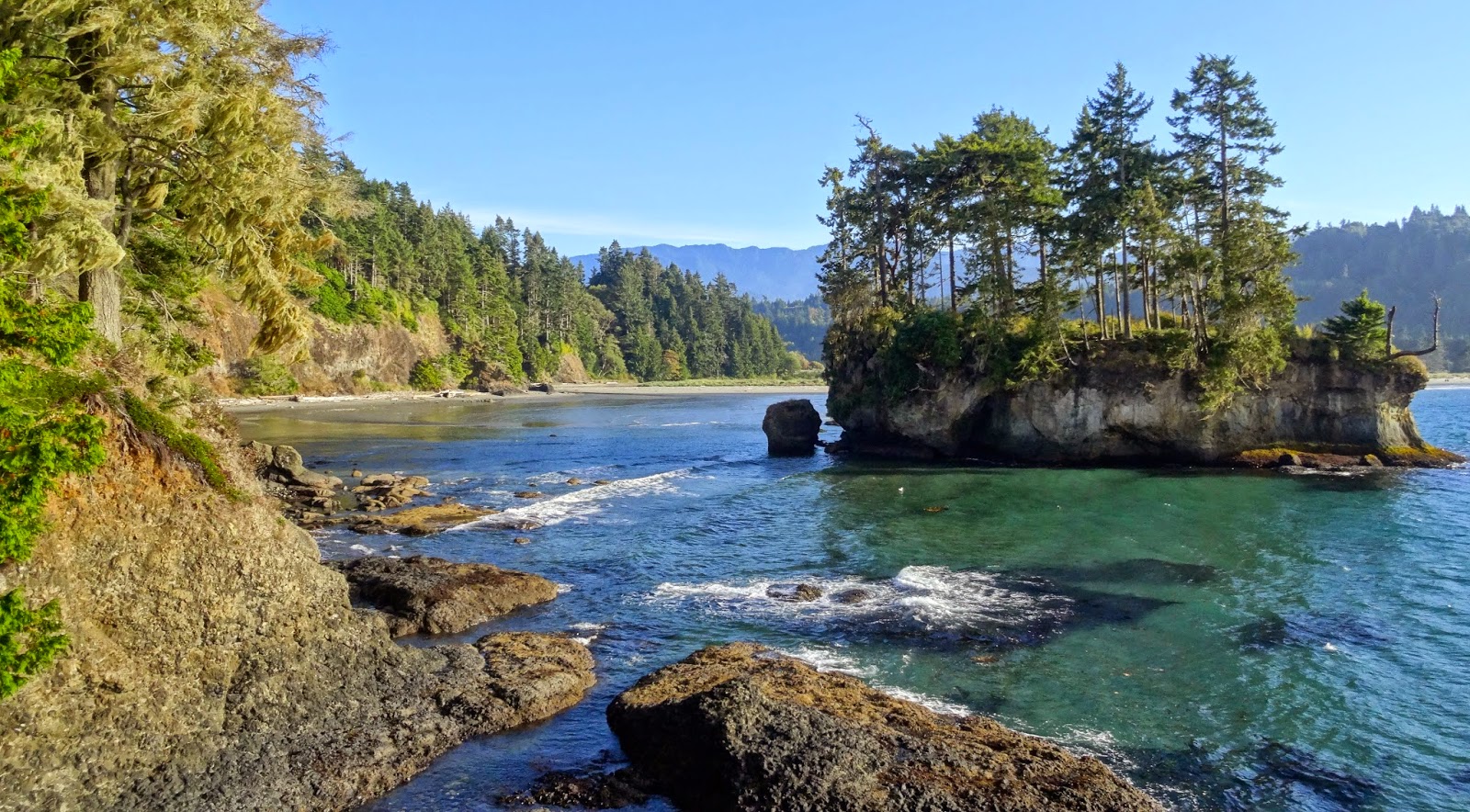
We've been staying at Salt Creek Recreation Area between the towns of Port Angeles, Washington, and Joyce, Washington, on the north side of the Olympic Peninsula. It's a 196-acre park with beautiful views. 

We took shady hikes, explored tide pools, and every evening watched deer grazing near the RV sites. Per certificates posted near the check-in area, a local newspaper proclaimed the park "Best place for a weekend getaway," "Best place to watch the sun set," and "Best county campground."  We thought the park should also win "Best view from an RV dump site" because it's not often you get to look at a huge strait with snow capped mountains in the background as you empty your black tank. I tried to take a photo but it just didn't do it justice.

A view on a hike at Salt Creek Recreation Area.
Salt Creek Recreation Area used to be Camp Hayden, a World War II military camp whose purpose was to protect the Strait of Juan de Fuca from hostile ships.  This is Jim standing under one of two abandoned gun batteries. 
Jim at a bed of washed ashore bull kelp. A Puget Sound Department of Ecology website I looked at said it's the fastest growing seaweed in the world and can get as long as 200 feet. When the bulb end floats along in the water it looks like a seal sticking its nose into the air. 
Bev near a tiny island.
Jim following a "you really are allowed to walk here" road less traveled.
A group of 28 artists spent a week at places near Port Angeles  creating one painting a day.  The project was called "Paint the Peninsula" and the results were on sale at the local fine arts center. The artist above was at Salt Creek.

Thursday, September 11, 2014

The Victoria, BC “Lick and a Promise” Tour

We didn't put much planning into our short trip to Victoria, British Columbia, but it worked out great.
A ferry takes people, dogs, bikes, cars, RVs, semi trucks and who knows what else across 26 miles of the Strait of Juan de Fuca from Port Angeles,WA, to Victoria and back.  We caught the 8:15 a.m. ferry on a clear, beautiful day.  We stood at the front of the ferry -- not quite in the Kate Winslet Titanic position -- watching nearby container ships and fishing boats. There was a little bit of excitement on our part when we overheard a guide pointing out "a bunch of human skulls" on a spit of land, only to realize later that he was a birder pointing out “Heerman's gulls.”

The ferry ride was 90 minutes. While on the ferry we purchased tickets for the “Hop-on Hop off" tour, another 90-minute trip -- this time narrated on a double decker bus -- that takes you around the city.  After the bus tour we had time to get lunch and walk around on our own before we took a return ferry at 3 p.m.  

Victoria is pretty, charming, bustling, and I’ve never seen so many flowers and well manicured private lawns and public spaces.  And no, we didn’t get to Butchart Gardens, one of the most famous gardens in the world. Our 15-year-old dog, Cooper, is content to sleep the day away, but we can’t leave him alone any longer than the 10 hours we were gone. Next time we need to camp in Canada.
View of Port Angeles, WA as we leave the city via the ferry.  Looks like a UFO is approaching on the top left, but I think that's glass glare.
Our ferry boat, the MV Coho, leaving Victoria for a return trip to Port Angeles.  The  341-foot-long ship was built in 1959 and was in great shape.  We later read that the so called "Millennium Bomber," who planned an explosion at LAX on New Years' Eve 1999, took this ferry from Victoria to Port Angeles.  He was arrested by border authorities in Port Angeles.
Our Hop-On Hop Off tour bus in Victoria, BC, with out tour guide John to the far left.  John is from London; he drives a tour bus there six months a year and then drives the bus in Victoria.  he took us to 14 stops, including the Empress Hotel, Chinatown, two harbors and a lot of streets where the tree branches missed our heads and my right shoulder by inches (we were on the top on the bus.)
The flower-covered Swan's Hotel in downtown Victoria.
Victoria is the capital of the province of British Columbia; above is BC's parliament building near the inner harbor.  The building was completed in 1897, the the year of Queen Victorias' Diamond Jubilee.  Our tour guide said Victoria is the capitol of BC instead of the much larger Vancouver (about 350,000 people in metro Victoria compared with 2.4 million in metro Vancouver) simply because Victoria was settled first.
A Disney cruise ship, left, and a Carnival Miracle ship, were docked not far from where our ferry docked.
Tour guide John told us there are over 1,000 hanging baskets in downtown Victoria.
More baskets.
Victoria was full of tourists.  As you got away from the harbor, which is to the immediate right of this photo, it was bustling with tourists and locals.  Busy city.
We saw people taking tours via about all transportation types imaginable (horses, bikes, boats, seaplanes, you name it) including the above amphibious bus.